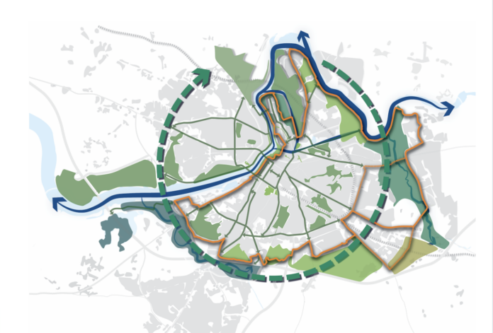
LIMERICK City and County Council has opened a public consultation with a view to creating what it describes as a Blue Green Ring Masterplan around the city.
The Blue Green Ring Masterplan would see an integrated network of water (blue) and land (green) spaces and corridors in Limerick City.
LUC, a multidisciplinary design team, has been appointed by the Council to progress the development of a Blue Green Ring (BGR) Masterplan, with the ambition to create Ireland’s fist city-scale amenity and ecological corridor.
The corridor would encompass many of Limerick’s key natural heritage assets, cross cutting and surrounding the ring.

- External Walls: Up to €8,000 Grant
- Attic: Up to €1,500 Grant
- Cavity Walls: Up to €1,700 Grant
- Internal Dry Lining: Up to €4,500 Grant
These include the River Shannon and some important wetlands such as Bunlicky, Coonagh, and Westfields. It also incorporates important habitats for fauna and flora such as King’s Island, Shannon Fields, the Baggot Estate, Ballinacurra Creek, Canal Bank, Toppin’s Field, Groody Valley, and areas north of Thomond Weir.
A non-statutory public consultation on the masterplan opened on November 15 and will run until December 17.
Mayor John Moran said that “Limerick City already boasts a wealth of natural assets, but this is about the development of a Blue Green Ring Masterplan, which offers a unique opportunity to connect our neighbourhoods and communities through nature and create attractive public spaces for a more liveable and more healthy city”.
“I encourage all citizens to participate in shaping the future development of this one-of-a-kind project. We need your ideas and feedback. We want you to play a vital role to take advantage of our transition to a low carbon and climate resilient society, to design Limerick as an attractive and distinctive place to live, work and visit,” Mayor Moran said.
Members of the public can take part in the consultation on the Limerick City and County Council MyPoint website, available on mypoint.limerick.ie/en/consultation/limerick-blue-green-ring-masterplan.

